Resources
eDNA Toolkit Project Partners Publications Data Resources Regulatory Information Stakeholder Meetings
In this section you will find links to important resources, including monitoring data for your area, links to publications, and details about our project partners.
eDNA Toolkit
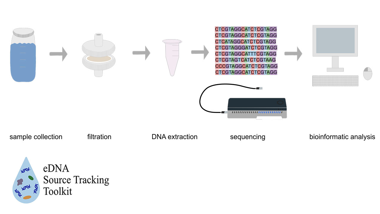
The goal of the eDNA Source Tracking Toolkit is to provide a workflow for using eDNA as a robust, cost-effective, and accessible next generation microbial source tracking tool. The eDNA Source Tracking Toolkit is a resource for using eDNA metagenomics as a fecal source tracking tool. Environmental DNA (eDNA) metagenomics techniques provide important biological context to source tracking identification by revealing bacterial community composition for a comprehensive assessment of water quality in a system.
A toolkit workshop will be hosted at the University of South Alabama on 25 April 2025. Please register by 4 April 2025.
Participants will learn best practices for eDNA sample collection, filtration, and DNA extraction. Participants will be able to engage in a hands-on sequencing run with a MinION sequencer and will be guided through subsequent bioinformatic analysis and key data visualization.
Learn more about the toolkit: https://sites.google.com/view/ednatoolkit.
Project Partners
NOAA National Science Collaborative
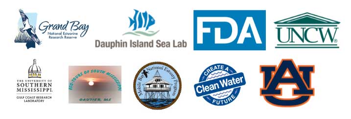
The study, Legacy effects of land-use change and nitrogen source shifts on a benchmark system: Building capacity for collaborative research leadership at the Grand Bay National Estuarine Research Reserve, was conducted by a team of researchers from the Dauphin Island Sea Lab (Dr. R.H. Carmichael, Dr. E. Darrow, E. Hieb), U.S. Food and Drug Administration (Dr. W. Burkhardt, III; CDR K. Calci), University of Southern Mississippi (Dr. W. Wu, Dr. E. Jackson), Auburn University (Dr. W. Walton), and the Grand Bay National Estuarine Research Reserve (Dr. A. Gray, Dr. M. Woodrey, K. Cressman) and stakeholder partner Eco-tours of South Mississippi (CAPT K. Wilkinson).
Transfer partners additionally included the University of North Carolina-Wilmington (E. Darrow) and the Mobile Bay National Estuary Program’s Create a Clean Water Future Campaign.
- Grand Bay National Estuarine Research Reserve
- Dauphin Island Sea Lab
- U.S. Food and Drug Administration
- University of North Carolina - Wilmington
- Gulf Coast Research Laboratory/ University of Southern Mississippi
- Eco-tours of South Mississippi
- Mobile Bay National Estuary Program
- Create a Clean Water Future
- Auburn University
US EPA Gulf of Mexico Division
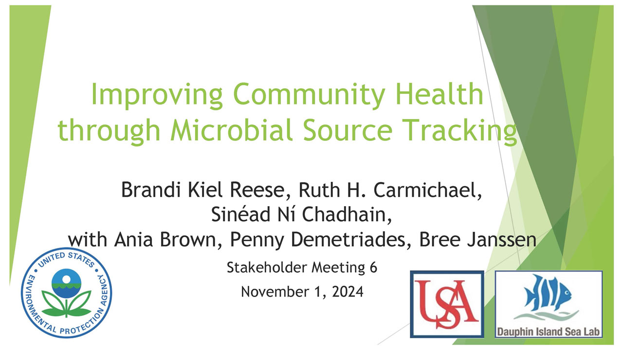
The study, Improving Community Health through Microbial Source Tracking, is slated to begin work 1 April 2022 by a team of researchers from the Dauphin Island Sea Lab and University of South Alabama (Dr. Brandi Kiel-Reese, Dr. R.H. Carmichael, Dr. Sinéad Ní Chadhain), with the participation and support of a wide range of local and regional stakeholder partners.
- Alabama Association of Conservation Districts
- Alabama Department of Conservation, Marine Resources Division
- Alabama Department of Environmental Management
- Alabama Marine Mammal Stranding Network
- Auburn University Shellfish Laboratory
- City of Mobile
- Dog River Clearwater Revival
- FDA Gulf Coast Seafood Laboratory
- Grand Bay National Estuarine Research Reserve
- Mississippi-Alabama Sea Grant Consortium
- Mobile Bay National Estuary Program
- Mobile Baykeeper
- Navy Cove Oyster Company
- Weeks Bay National Estuarine Research Reserve
Peer-Reviewed Publications
Darrow, E.S., R.H. Carmichael, C.F.T. Andrus, H.E. Jackson (2017a) From middens to modern estuaries, oyster shells sequester source-specific nitrogen. Geochimica et Cosmochimica Acta 202:39-56
Darrow, E.S., R.H. Carmichael, K.R. Calci, W. Burkhardt III (2017b) Land-use related changes to sedimentary organic matter in tidal creeks of the northern Gulf of Mexico. Limnology and Oceanography doi:10.1002/lno.10453
Gancel Dissertation. (2020) Larval Oyster (Crassostrea Virginica) settlement and distribution in a freshwater-dominated and human-influenced estuary.
Groet, T.M., E.E. Hieb, E.S. Darrow, and R.H. Carmichael. (2021) Our Wastewater Footprint: Protecting Water Quality Through Comprehensive Coproduction of Knowledge. Case studies in the Environment.5(1):1425563.doi.org/10.1525/cse.2021.1425563.
Frith.A., J. Henseler, S. Badri, K.R. Calici, A. Stenson, and R.H. Carmichael. (2021) Multiple Indicators of Wastewater Contamination to Shellfish Farms Near a Tidal River. Estuaries and Coasts. doi.org/10.1007/s12237-021-01033-x.
Data Resources
National Estuarine Research Reserve: System-Wide Monitoring Program (SWMP)
- Long-term monitoring data across the 26 reserve sites in the NERR system is available through the Centralized Data Management Office, including water quality, meteorological, and nutrient data.
Gulf of Mexico Coastal Training Program (CTP)
- The CTP is a unique collaboration between the five Gulf Coast National Estuarine Reserve Reserves (NERR), which serves as a bridge between science, policy, and coastal resource management across the Gulf region.
- Visit the CTP Workshops page to find training programs on priority issues such as water quality and community resilience, or suggest a workshop by sharing ideas about your community needs and interests.
U.S. Geological Survey (USGS) Water Resources
Streamflow data, used to inform water management, is available through the USGS National Water Information System (NWIS). Access additional data on groundwater, water quality, and water use and availability through USGS Water Resources.
- Streamflow and water quality stations used for this project include:
- 02471089 and 02471088 in Bayou Heron
- 02471091 at Bayou Cumbest
- 02471086 at Carls Creek near Bayou La Batre
- 0247109250 at Bayou Chico
National Oceanic and Atmospheric Administration (NOAA): National Data Buoy Center
- As part of the National Weather Service, the NDBC operates a series of ~150 data collecting buoys and coastal stations, providing high quality meteorological and environmental data in the open ocean and coastal zone surrounding the U.S. Access real-time and historical data on marine conditions using NDBC’s Interactive Map.
Gulf of Mexico Coastal Ocean Observing System (GCOOS)
- GCOOS aggregates environmental data from regional providers across the Gulf of Mexico for use by decision-makers, including researchers, government managers, industry, military, educators, emergency responders, and the general public.
GulfTREE (Tools for Resilience Exploration Engine)
- GulfTREE was created through a partnership of the Northern Gulf of Mexico Sentinel Site Cooperative (SSC), the Gulf of Mexico Climate Resilience Community of Practice (CoP), and the Gulf of Mexico Alliance Resilience Team (GOMA).
- Designed as an interactive decision-support tree, GulfTREE helps end-users, including governments, community planners, and natural resource managers, select appropriate tools, such as land-use change models and stormwater calculators, to incorporate climate resiliency into future projects.
Dauphin Island Sea Lab’s Data Management Center
- DISL’s Data Management Center oversees the quality, retention, and accessibility of research and monitoring data collected by DISL personnel, including creation and publication of federally compliant metadata.
- The center also supports the Alabama Real-Time Coastal Observing System, an extensive network of real-time environmental monitoring stations across coastal Alabama that collects hydrographic and meteorological data.
Mobile Bay National Estuary Program
- Access the NEP library for a list of publications, management plans, policies, and reviews from the Mobile Bay National Estuary Program.
Auburn University Water Resources Center
- The goal of the Water Resources Center is to facilitate research collaborations and outreach programs that promote the involvement of private citizens in the stewardship of water resources.
- Alabama Water Watch is a program focused on watershed stewardship through volunteer monitoring efforts. Learn about ways to get involved in water quality citizen science and upcoming events in your area on their events page.
EPA Environmental Dataset Gateway
The Environmental Protection Agency’s Environmental Dataset Gateway allows users to search by local watersheds to narrow down useful content for your community.
USDA’s Natural Resources Conservation Service (NRCS)
- On the NRCS homepage, you can find a list of USDA sponsored programs to provide information on water quality, watershed management, conservation and restoration initiatives, and policy related to agricultural practices that affect waterways.
- NRCS’s Agricultural Water Enhancement Program (AWEP) is a voluntary conservation initiative that provides financial and technical assistance to agricultural producers whose practices enhance water quality through conserving ground and surface waters and reducing nutrient inputs.
- Access the National Resources Inventory to find survey data on land use and natural resource conditions and trends on U.S. non-Federal lands.
- Through the NRCS Manure and Nutrient Management page, farmers and ranchers can find useful information and tools to protect water quality by effectively and profitably managing animal waste and fertilizer use.
National Estuarine Eutrophication Assessment (NEAA)
- Download the report on “Effects of nutrient enrichment in the nation’s estuaries: A decade of change” to see how estuary eutrophication levels across the U.S. have changed since 1999.
- Use the NEEA Estuaries Database and an interactive map to find relevant data for your local estuary, including categories of domestic land use and annual sediment and nutrient loads to local waterways.
Utilities United - Alabama Coastal Foundation (ACF)
- Utilities United is to educate the public about the importance of our local environment and what people can do to help keep it healthy.
- Find relevant information about your local water, wastewater, and stormwater.
- Look at Water and Wastewater Statistics for Coastal Alabama Utilities
National Centers for Coastal Ocean Science (NCCOS) Phytoplankton Monitoring Network
- The Phytoplankton Monitoring Network is a community-based volunteer network monitoring marine phytoplankton and harmful algal blooms as well as conditions linked to phytoplankton species composition and distribution.
National Centers for Coastal Ocean Science (NCCOS) Vibrio Predictive Models
- Though naturally occurring in coastal waters, Vibrio species can be harmful to human health, most commonly related to consumption of raw or undercooked seafood. Vibrio Predictive Models forecast expected daily Vibrio concentrations in oysters from the Northern Gulf of Mexico as well as other regions.
- These predictive models can be used by managers and individual growers to make decisions regarding safe harvesting of oysters.
Community Collaborative Rain, Hail, and Snow Network (CoCoRaHS)
- CoCoRaHS is a community-based volunteer network working to measure and map precipitation across the U.S. Precipitation is linked to water quality, making these data valuable to many end-users.
Regulatory Information
U.S. Environmental Protection Agency (EPA): Clean Water Act
- Established in 1972, the Clean Water Act sets federal water quality standards and regulates wastewater and other discharge into U.S. waters through the National Pollutant Discharge Elimination System (NPDES).
- Find water pollutant loading reports for permitted facilities nationwide by searching EPA’s Enforcement and Compliance History Online.
- NPDES permit numbers for the Grand Bay region include:
- Wastewater treatment plants:
- AL0078921 and AL0022632 – Bayou La Batre
- MS0020249 and MS0045446 – Pascagoula/Moss Point
- MS0055387 – Pascagoula at Bayou Casotte
- MS002151 – Escatawpa
- Industrial outputs:
- MS0001481 – Chevron Products Pascagoula Refinery
- MS0003069 – Ingalls Shipbuilding
- MS0003115 – Mississippi Phosphates
Mississippi Department of Environmental Quality (MDEQ)
The MDEQ Office of Pollution Control develops and regulates water quality standards through its Surface Water Division. According to MDEQ, polluted runoff is the leading cause of water quality problems in Mississippi.
- Water bodies must meet water quality standards according to their designated use including drinking water supply, recreation, shellfish harvesting, fish consumption, and support of aquatic life. Water quality standards for MS can be found under Regulations for Water Quality Criteria for Intrastate, Interstate, and Coastal Waters.
U.S. FDA: National Shellfish Sanitation Program (NSSP)
- Through the NSSP, US FDA works cooperatively with other federal, state, and tribal regulatory agencies and the shellfish industry to ensure safe consumption of molluscan shellfish such as oysters, clams, mussels, and scallops.
- Current guidelines for growth, processing, and shipping of shellfish for human consumption can be found in the NSSP Guide for the Control of Molluscan Shellfish.
Alabama Department of Public Health (ADPH)/ Alabama Department of Environmental Management (ADEM)
The ADEM/ADPH Coastal Alabama Beach Monitoring Program collects water quality data from 25 public recreational sites and uses a three-tiered color-coded water quality status system to illustrate levels of indicator bacteria in relation to EPA thresholds.
- Find resources on fish consumption safety including safe types of fish to eat and safe ways to prepare fish. ADEM’s interactive Fish Consumption Advisories map allows users to view advisories by waterbody, species, and contaminant concern.
Stakeholder Meetings
November 2024